Chestnut Top Trail
terrainOutdoors - Hiking Trails

Chestnut Top Trail: A Quiet Climb Through Smoky Mountain History

starstarstarstar½ 4.4 (543 reviews)
location_onGreat Smoky Mountains NP scheduleSunrise to Sunset timer3-4 hours
Nature Lovers Scenic Views

About

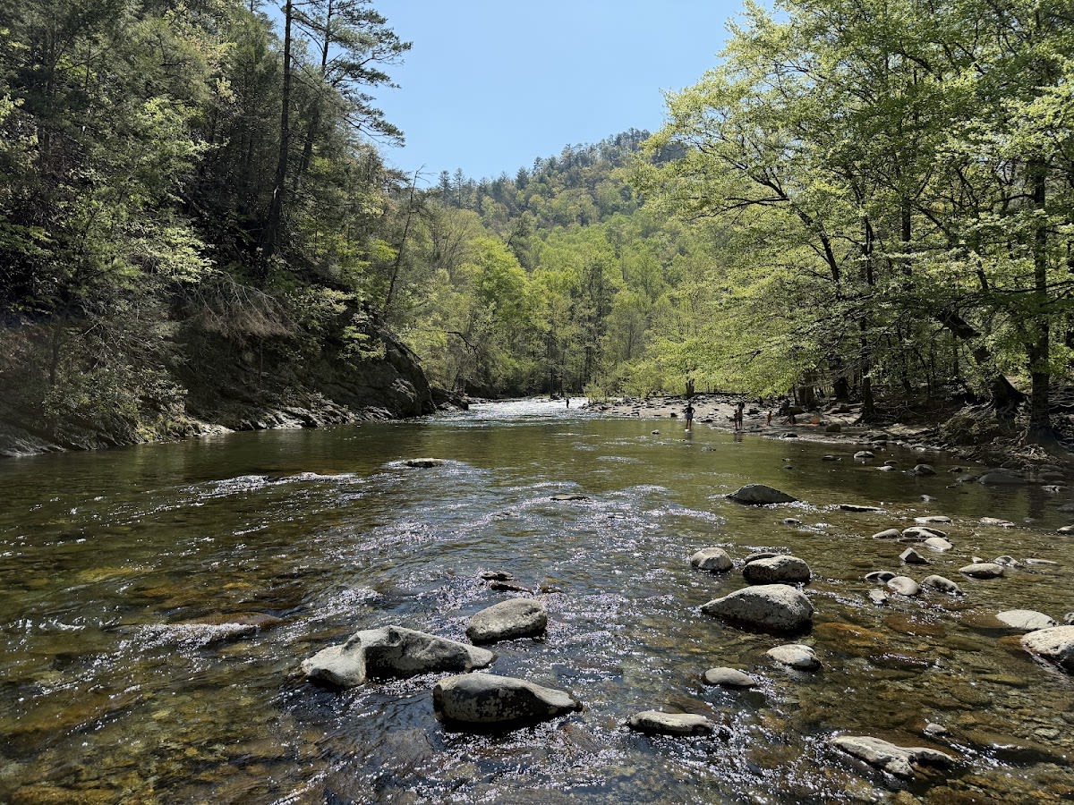
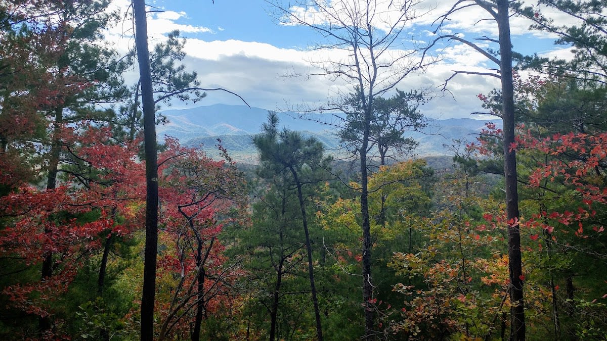
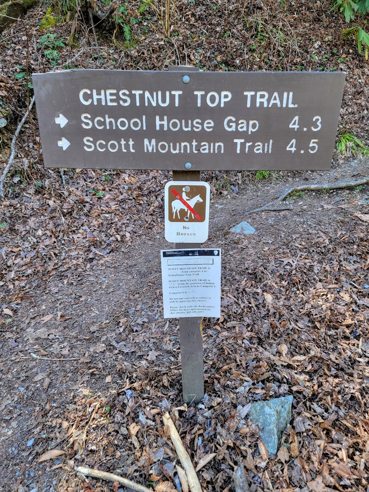
Chestnut Top Trail is a 5.6-mile roundtrip hike located in Great Smoky Mountains National Park, Tennessee. The trail steadily ascends through a mixed hardwood forest, leading hikers to a scenic ridgetop once populated by American chestnut trees. This moderately challenging route offers a quieter alternative to busier trails in the park. Visitors can enjoy seasonal wildflowers in spring and vibrant foliage in autumn.

The trail’s namesake, the American chestnut, was once a dominant species in the Smokies before being devastated by chestnut blight in the early 20th century. The forest here tells a story of resilience, with younger trees and diverse hardwoods now filling the canopy. Geologically, the trail climbs over ancient Precambrian rock formations characteristic of the region. The area holds cultural significance for early settlers and Native American tribes who relied on the land’s resources.

Hikers on Chestnut Top Trail can expect a peaceful journey with limited foot traffic compared to more popular areas. The trail’s gradual climb allows for steady progress, making it suitable for those seeking a moderate challenge. Along the way, keep an eye out for wildflowers such as trilliums and violets in spring and colorful maples and oaks in fall. The ridgetop provides open views and a quiet spot to rest before returning.

Did You Know

  • American chestnut trees once made up about 25% of the forest in the Smokies before chestnut blight (National Park Service).
  • Chestnut Top Trail is less frequented than nearby Kuwohi, offering solitude for nature lovers (Great Smoky Mountains Association).
  • The trail passes through hardwood species including oak, hickory, and tulip poplar, common in the region (US Forest Service).
  • Spring wildflowers along the trail include trilliums, bloodroot, and violets, signaling the changing seasons (Southeastern Flora Guide).
  • The trail climbs over Precambrian metamorphic rock, some of the oldest exposed rock in the eastern United States (Geological Society of America).
Fall Colors GSMNP Hiking Moderate Hike Scenic Wildflowers
location_on
Address
Townsend Area, Great Smoky Mountains NP
schedule
Hours
Sunrise to Sunset
timer
Typical Visit
3-4 hours

Frequently Asked Questions

How difficult is the Chestnut Top Trail hike?

The hike is moderately challenging with a steady climb, suitable for hikers with some experience and average fitness.

Are dogs allowed on Chestnut Top Trail?

Pets are not permitted on trails within Great Smoky Mountains National Park to protect wildlife and natural resources.

Where is the nearest town to Chestnut Top Trail?

Pigeon Forge is the closest town, located just a few miles from the trailhead.

Is parking available at the Chestnut Top Trail trailhead?

Yes, there is a small parking area at the trailhead, but it can fill up on busy days, so arriving early is recommended.

Can I see wildlife on this trail?

Yes, the area is home to various wildlife including deer, birds, and occasionally black bears. Maintain a safe distance and do not feed animals.

Take Home a Piece of Chestnut Top Trail

Branded LocaleTrips sticker set arriving soon. Use the trail cam Bigfoot sticker, the heritage benchmark, and the editorial portrait on your water bottle, laptop, or Instagram story.

Field Notes

Last reported Bigfoot sighting near Chestnut Top Trail: On August 14, 2024, a group of hikers reported seeing a large, shadowy figure near the ridgetop area of Chestnut Top Trail. The figure was described as tall with broad shoulders, quickly disappearing into the trees. While no proof was found, the tale adds to the trail’s quiet mystique.

More in Great Smoky Mountains NP

Things to do nearby
Schoolhouse Gap Trail

Schoolhouse Gap Trail

terrainEasy 4.4-mile roundtrip on a wide, gentle trail.
star 4.3 - 543 reviews
Spruce Flats Falls Trail

Spruce Flats Falls Trail

terrainModerate 2-mile roundtrip to a waterfall with a swimming hole.
star 4.7 - 1,234 reviews
Middle Prong Trail

Middle Prong Trail

terrainEasy 4.1-mile one-way trail along a beautiful stream with old-growth trees.
star 4.5 - 765 reviews
Kanati Fork Trail

Kanati Fork Trail

terrainModerate 2.9-mile trail in Great Smoky Mountains National Park.
star 4.6287096586158745 - 576 reviews
Rich Mountain Loop Trail

Rich Mountain Loop Trail

terrainModerate 8.5-mile loop with panoramic views from Cades Cove.
star 4.6 - 876 reviews
Cades Cove Loop Road

Cades Cove Loop Road

local_activity11-mile scenic loop through a historic valley. Excellent wildlife viewing, prese
star 4.8 - 12,543 reviews
Browse Cabins Call