Chimney Tops Trail
terrainOutdoors - Hiking Trails

Chimney Tops Trail: A Steep Ascent to Scenic Smoky Mountain Views

starstarstarstar½ 4.6 (4,567 reviews)
location_onGreat Smoky Mountains NP scheduleSunrise to Sunset timer2-4 hours
Hidden Gems Nature Lovers Scenic Views

About

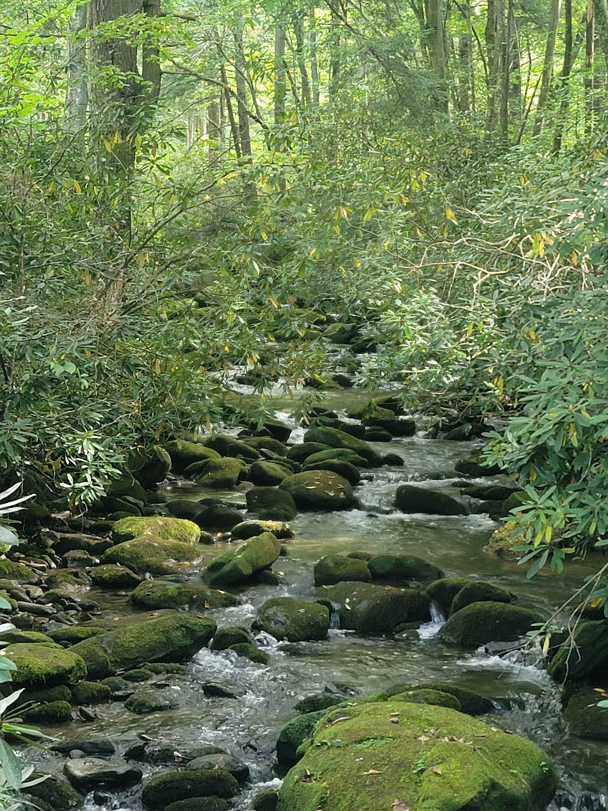
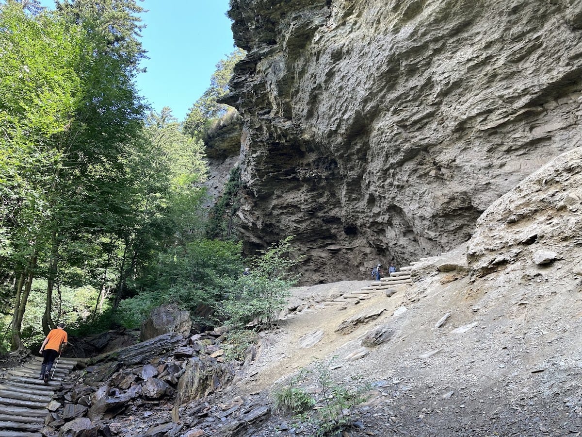
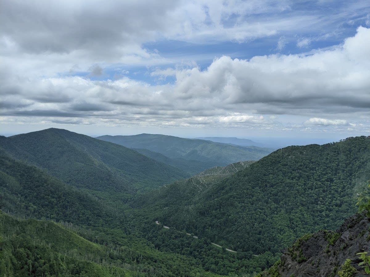
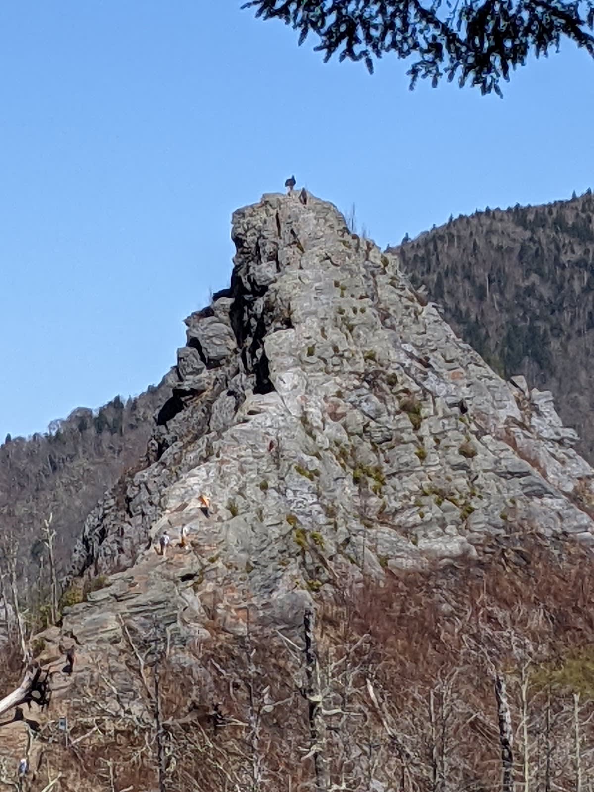
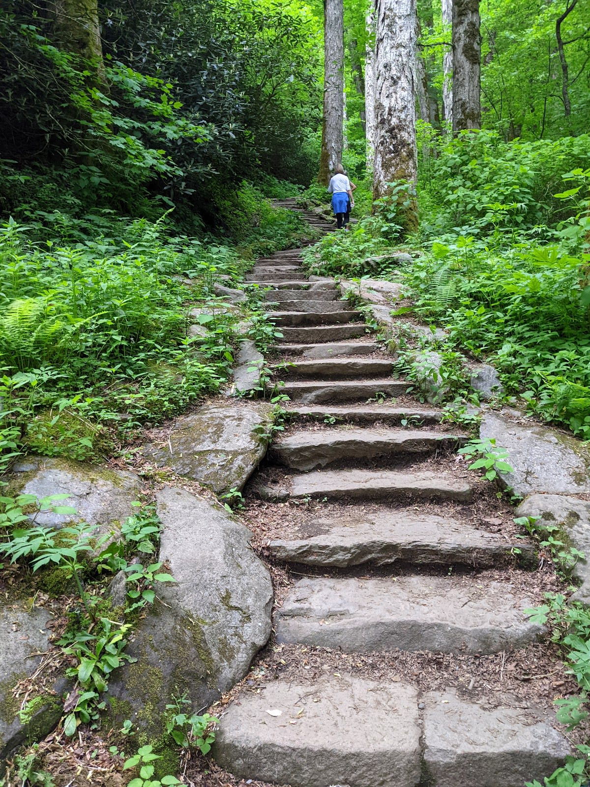
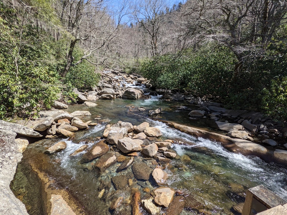
Chimney Tops Trail is a rugged terrain hike located in Great Smoky Mountains National Park, Tennessee. The trail leads hikers through dense forest and rocky sections toward distinctive twin rock pinnacles. Although the last portion to the summit is closed due to wildfire damage, the open section offers a rewarding experience over approximately two miles. This trail is known for its steep ascent and significant elevation gain, making it a challenging yet popular choice for many visitors.

The Chimney Tops rock formations are remnants of ancient magma that cooled slowly beneath the Earth’s surface, creating the unique granite pinnacles seen today. The area was heavily impacted by the 2016 wildfires, which led to the closure of the final summit section for safety reasons. Historically, these formations have been a notable landmark for generations of locals and hikers. The trail itself traverses a diverse ecological zone, showcasing the rich flora and fauna characteristic of the Smokies.

Visitors to Chimney Tops Trail can expect a vigorous hike with steep climbs and rocky terrain. The open trail section winds through lush forest, with occasional clearings providing glimpses of the surrounding mountains. While the summit is off-limits, hikers still enjoy scenic views and the challenge of the trail. It's recommended to wear sturdy footwear and bring plenty of water, as the elevation gain can be demanding. Checking current trail conditions with park services is advised before setting out.

Did You Know

  • The Chimney Tops rock formations are made of granitic gneiss, dating back over 400 million years (National Park Service).
  • The 2016 wildfires in the Great Smoky Mountains were some of the most destructive in the park's history (NPS Fire Management).
  • Chimney Tops Trail is one of the few trails in the park that gains over 1,000 feet in elevation within just one mile (Great Smoky Mountains Hiking Guides).
  • The trail passes through a transition zone between northern hardwood and southern cove forests (Southeastern Forest Experiment Station).
  • Kuwohi, formerly known as Kuwohi, is the highest point in the Smokies, located nearby the Chimney Tops area (Great Smoky Mountains Institute).

videocam Watch Video

GSMNP Scenic Trails
location_on
Address
Newfound Gap Rd, Great Smoky Mountains NP
schedule
Hours
Sunrise to Sunset
timer
Typical Visit
2-4 hours

Frequently Asked Questions

Is the Chimney Tops Trail summit currently open?

No, the final section to the summit has been closed since the 2016 wildfires due to safety concerns. The open portion remains accessible.

How difficult is the Chimney Tops Trail hike?

The trail is considered strenuous due to steep grades and rocky terrain, with significant elevation gain over a short distance.

Are dogs allowed on Chimney Tops Trail?

Pets are not permitted on most trails within Great Smoky Mountains National Park, including Chimney Tops Trail.

What should I bring for a hike on Chimney Tops Trail?

Wear sturdy hiking shoes, bring water, snacks, sun protection, and check weather conditions before hiking.

How far is Chimney Tops Trail from Pigeon Forge?

The trailhead is approximately 20 miles from Pigeon Forge, making it an accessible day trip for visitors.

Take Home a Piece of Chimney Tops Trail

Branded LocaleTrips sticker set arriving soon. Use the trail cam Bigfoot sticker, the heritage benchmark, and the editorial portrait on your water bottle, laptop, or Instagram story.

Field Notes

Last reported Bigfoot sighting near Chimney Tops Trail: On April 12, 2024, a hiker reported seeing a large, shadowy figure near the Chimney Tops trailhead just before dawn. The figure reportedly moved quickly through the underbrush, disappearing before a closer look. Whether Bigfoot or a brisk black bear, the sighting added a bit of local lore to the area.

More in Great Smoky Mountains NP

Things to do nearby
Jakes Creek Trail

Jakes Creek Trail

terrainModerate 3.7-mile trail in Great Smoky Mountains National Park.
star 4.804496809673502 - 138 reviews
Alum Cave Trail

Alum Cave Trail

terrainAmong the park's most scenic hikes. Arch Rock, dramatic bluffs, mountain vi
star 4.8 - 6,789 reviews
Miry Ridge Trail

Miry Ridge Trail

terrainModerate 5-mile trail in Great Smoky Mountains National Park.
star 4.54217267731555 - 156 reviews
Spring Wildflower Pilgrimage

Spring Wildflower Pilgrimage

local_activityAnnual spring event celebrating Smokies wildflowers. Guided walks, programs, pho
star 4.8 - 1,234 reviews
Cove Hardwood Nature Trail

Cove Hardwood Nature Trail

terrainEasy 0.75-mile loop through a forest of giant old-growth trees.
star 4.6 - 1,234 reviews
Mount LeConte via Alum Cave Trail

Mount LeConte via Alum Cave Trail

terrainStrenuous 10.2-mile roundtrip to the third highest peak in the Smokies.
star 4.9 - 5,678 reviews
Browse Cabins Call