Roundtop Trail
terrainOutdoors - Hiking Trails

Roundtop Trail: A Serene Summit Experience in the Smokies

starstarstarstar½ 4.756908438307128 (189 reviews)
location_onGreat Smoky Mountains NP scheduleSunrise to sunset timer3-6 hours
Hidden Gems Nature Lovers Scenic Views

About

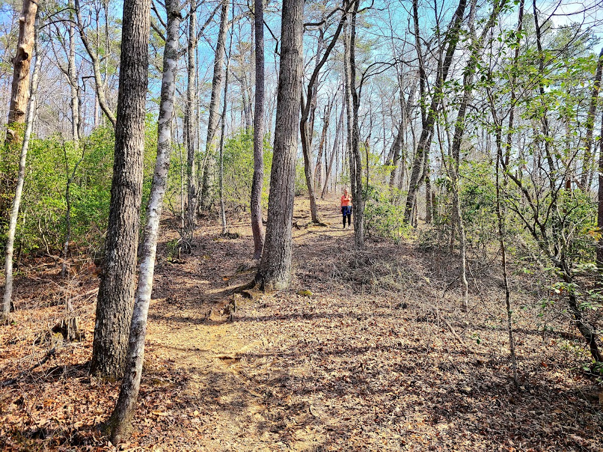
Roundtop Trail is a moderately challenging hike within Great Smoky Mountains National Park that leads to a gentle summit with sweeping views of the surrounding peaks. The trail is framed by seasonal wildflowers and expansive skies, providing hikers with a peaceful natural setting. It appeals to those looking for a rewarding climb without overly strenuous terrain. The ascent is gradual, making it accessible for many outdoor enthusiasts seeking to experience the park’s diverse landscape.

The Smoky Mountains are part of the ancient Appalachian range, formed over 200 million years ago during the uplift of the Earth's crust. Roundtop itself is composed primarily of Precambrian sandstone, contributing to the rugged yet gentle profile of the summit. Historically, the area was home to the Cherokee people, who valued these lands for hunting and gathering. Over time, the region became a protected national park, preserving both its natural beauty and cultural significance.

Visitors to Roundtop Trail often remark on the quiet solitude found along the path, interrupted only by the sounds of birds and rustling leaves. The panoramic views from the summit provide excellent opportunities for photography, especially during early morning or late afternoon light. Hikers can expect to encounter a variety of wildflowers in bloom during spring and summer, adding color to the green mountain backdrop. The trail is less crowded than some other routes in the park, offering a more intimate experience with the Smokies’ terrain.

Did You Know

  • Roundtop Trail gains approximately 1,200 feet in elevation over its 3.5-mile length (National Park Service).
  • The Great Smoky Mountains are named for the natural fog that often hangs over the range, resembling smoke (National Park Service).
  • Kuwohi, nearby, is the highest point in Tennessee at 6,643 feet (US Geological Survey).
  • Wildflowers along Roundtop Trail include trillium, violets, and mountain laurel, blooming from April through June (Great Smoky Mountains Wildflower Pilgrimage).
  • The Cherokee called the Smokies 'Shaconage,' meaning 'place of blue smoke' (Eastern Band of Cherokee Indians).
Free Hiking Moderate National Park
location_on
Address
Great Smoky Mountains National Park
schedule
Hours
Sunrise to sunset
timer
Typical Visit
3-6 hours

Frequently Asked Questions

How long is Roundtop Trail and what is the difficulty level?

Roundtop Trail is approximately 3.5 miles one way with a moderate elevation gain of about 1,200 feet, suitable for hikers with a moderate fitness level.

Are pets allowed on Roundtop Trail?

Pets are not allowed on most trails within Great Smoky Mountains National Park, including Roundtop Trail, to protect wildlife and natural resources.

What wildlife might I see on Roundtop Trail?

Visitors may spot deer, black bears, various bird species, and smaller mammals such as squirrels and chipmunks along the trail.

Is there water available along the trail?

There are no reliable water sources on Roundtop Trail, so hikers should bring sufficient water for the duration of their hike.

What is the best way to access Roundtop Trail from Pigeon Forge?

The trailhead is accessible by car via Newfound Gap Road; it is about a 30-minute drive from Pigeon Forge heading into the park.

Take Home a Piece of Roundtop Trail in Great Smoky Mountains NP

Branded LocaleTrips sticker set arriving soon. Use the trail cam Bigfoot sticker, the heritage benchmark, and the editorial portrait on your water bottle, laptop, or Instagram story.

Field Notes

Last reported Bigfoot sighting near Roundtop Trail in Great Smoky Mountains NP: On August 17, 2024, a hiker reported seeing a large, shadowy figure near the summit of Roundtop Trail just before sunset. The figure appeared to be moving cautiously through the trees but disappeared quickly when approached. No footprints were found, leaving the sighting a curious mystery among local hikers.

More in Great Smoky Mountains NP

Things to do nearby
Wet Bottom Trail

Wet Bottom Trail

terrainEasy 1.4-mile trail in Great Smoky Mountains National Park.
star 4.549049994100993 - 409 reviews
Bradley Fork Trail

Bradley Fork Trail

terrainEasy 7.3-mile trail in Great Smoky Mountains National Park.
star 4.692239315341487 - 469 reviews
Long Hungry Ridge Trail

Long Hungry Ridge Trail

terrainModerate 4.5-mile trail in Great Smoky Mountains National Park.
star 4.763525061061351 - 541 reviews
Forney Creek Trail

Forney Creek Trail

terrainModerate 11.4-mile trail in Great Smoky Mountains National Park.
star 4.528654228884064 - 529 reviews
Hughes Ridge Trail

Hughes Ridge Trail

terrainModerate 5-mile trail in Great Smoky Mountains National Park.
star 4.515252711928765 - 271 reviews
Hemphill Bald Trail

Hemphill Bald Trail

terrainModerate 8.4-mile trail in Great Smoky Mountains National Park.
star 4.730755762178495 - 248 reviews
Browse Cabins Call