Ace Gap Trail
terrainOutdoors - Hiking Trails

Ace Gap Trail: A Quiet Passage Through the Smokies' Forested Terrain

starstarstarstar½ 4.813126766741135 (212 reviews)
location_onGreat Smoky Mountains NP scheduleSunrise to sunset timer3-6 hours
Hidden Gems Nature Lovers Scenic Views

About

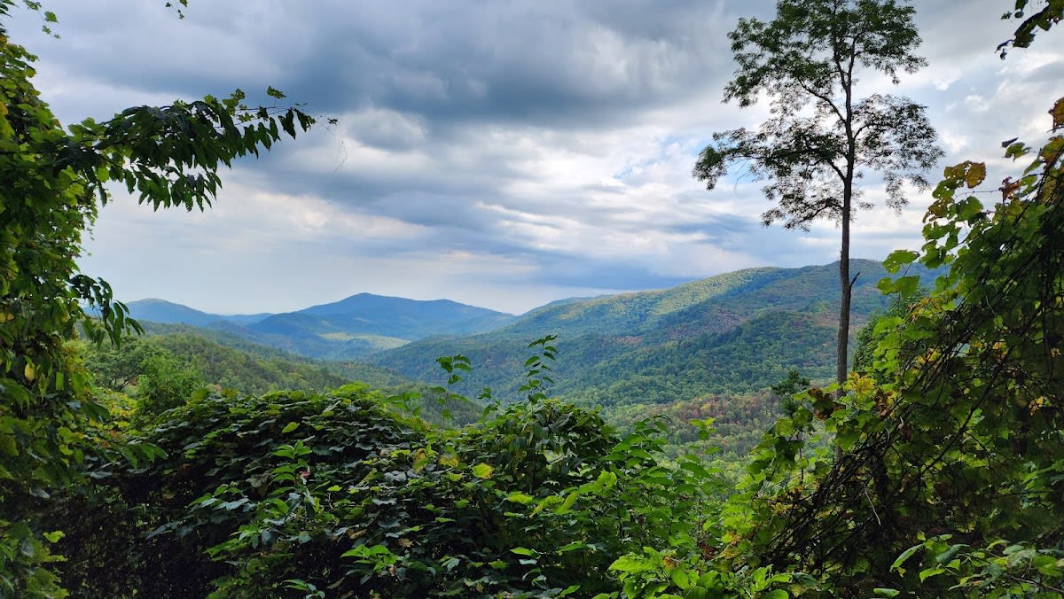
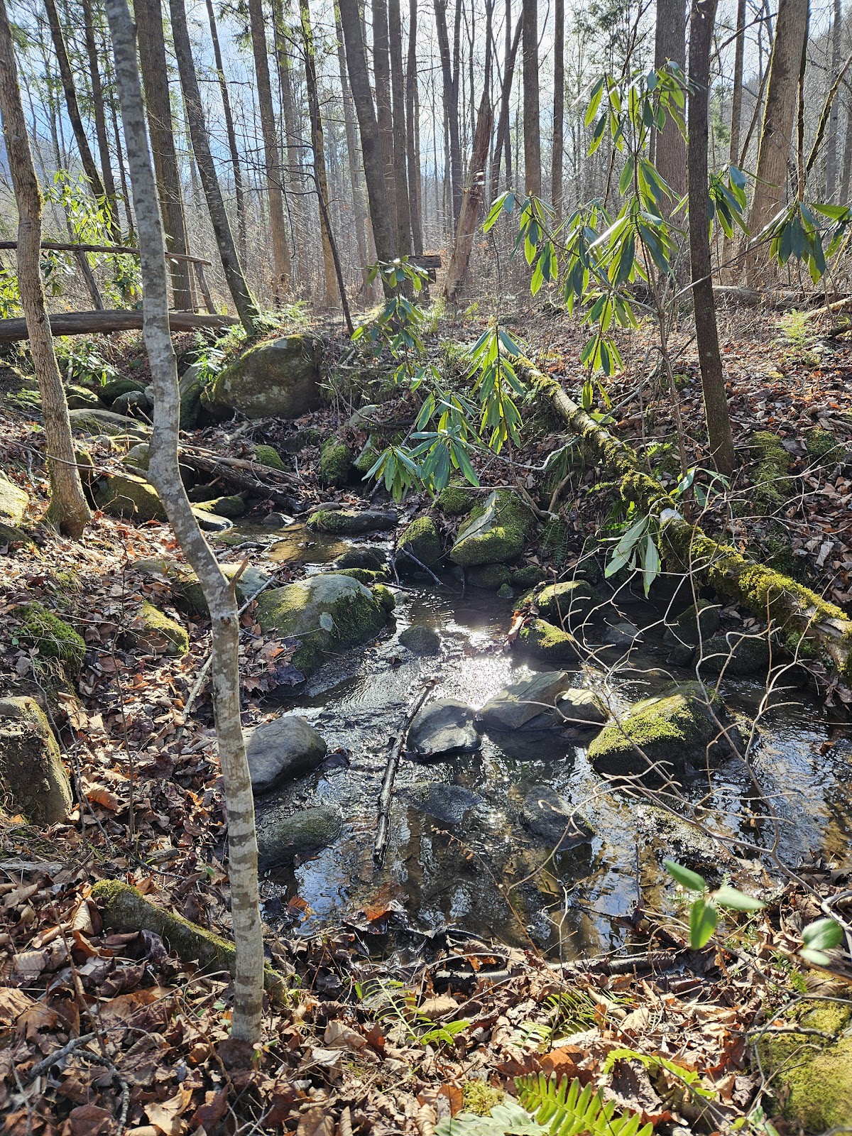
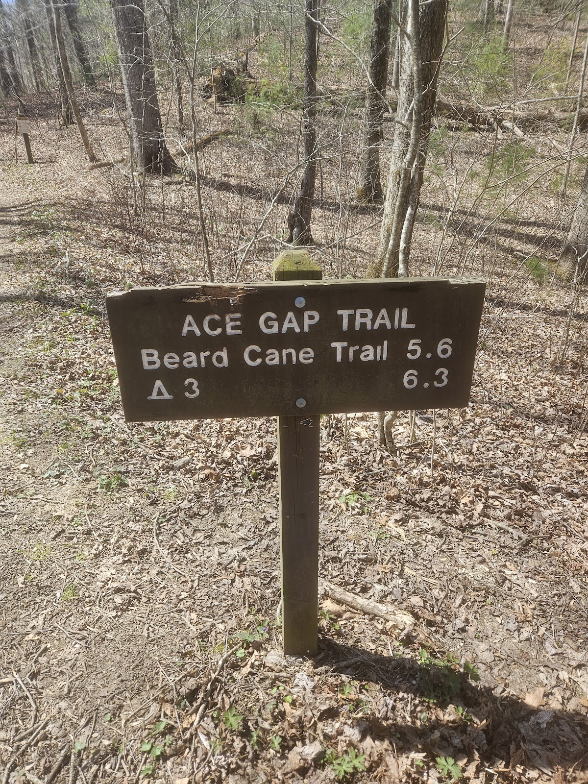
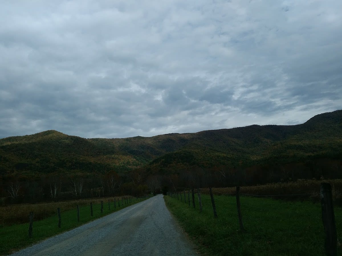
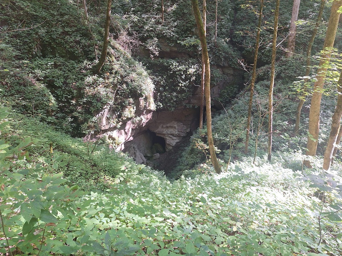
Ace Gap Trail is a lesser-known hiking route in Great Smoky Mountains National Park, Tennessee. It serves as a connecting path between Beard Cane and Rich Mountain Road, winding through a tranquil forested area. The trail offers a peaceful alternative to busier routes and allows hikers to experience the Smokies’ natural beauty up close. Its moderate terrain makes it accessible for those looking to enjoy a quiet walk immersed in nature.

The trail traverses an area shaped by ancient geological forces that formed the Appalachian Mountains, with underlying rock formations dating back hundreds of millions of years. Historically, these paths were used by early settlers and Cherokee inhabitants for travel and hunting. The forest along Ace Gap Trail is dominated by hardwood species and supports a diverse ecosystem typical of the Smokies. Seasonal changes highlight the trail’s dynamic character from vibrant fall foliage to lush summer greens.

Visitors to Ace Gap Trail will find a serene hiking experience away from the more crowded sections of the park. The trail’s gentle slopes and shaded canopy create a comfortable setting for birdwatching and spotting native wildlife like white-tailed deer and wild turkey. The connection between Beard Cane and Rich Mountain Road makes it a useful segment for longer loop hikes or quiet day treks. Hikers should prepare for limited signage and bring a map or GPS for navigation.

Did You Know

  • Ace Gap Trail is part of a network of old logging roads repurposed for hiking (Great Smoky Mountains NP archives).
  • The name 'Ace Gap' likely refers to a local term for a narrow pass used by early settlers (Smoky Mountain Historical Society).
  • The surrounding forest includes several tree species over 100 years old (US Forest Service).
  • The trail area provides habitat for the elusive northern flying squirrel (National Park Service wildlife reports).
  • Rich Mountain Road, connected via Ace Gap Trail, was once a critical route for early 20th-century timber operations (Great Smoky Mountains Historical Association).
Free Hiking Moderate National Park
location_on
Address
Great Smoky Mountains National Park
schedule
Hours
Sunrise to sunset
timer
Typical Visit
3-6 hours

Frequently Asked Questions

How long is Ace Gap Trail?

The trail is approximately 2.5 miles in length, connecting Beard Cane to Rich Mountain Road.

Is the trail suitable for beginners?

Yes, Ace Gap Trail offers moderate terrain with gentle inclines, making it accessible to hikers with some experience.

Are there any water sources along the trail?

There are no reliable water sources directly on the trail, so hikers should carry sufficient water.

Is the trail dog-friendly?

Dogs are allowed on Ace Gap Trail but must be kept on a leash at all times in accordance with park rules.

What wildlife might I see on Ace Gap Trail?

Common sightings include white-tailed deer, wild turkey, various songbirds, and possibly black bears if you are lucky.

Take Home a Piece of Ace Gap Trail

Branded LocaleTrips sticker set arriving soon. Use the trail cam Bigfoot sticker, the heritage benchmark, and the editorial portrait on your water bottle, laptop, or Instagram story.

Field Notes

Last reported Bigfoot sighting near Ace Gap Trail: On October 12, 2024, a group of hikers reported spotting a large, hairy figure near the ridge at Ace Gap Trail late in the afternoon. The creature was described as standing upright and moving silently through the trees before vanishing into the forest. While no photos were captured, the story has added a bit of local legend to this quiet trail.

More in Great Smoky Mountains NP

Things to do nearby
Finley Cane Trail

Finley Cane Trail

terrainEasy 2.8-mile trail in Great Smoky Mountains National Park.
star 4.61849201928752 - 399 reviews
Thomas Divide Trail

Thomas Divide Trail

terrainModerate 14.5-mile trail in Great Smoky Mountains National Park.
star 4.693522823338932 - 200 reviews
Caldwell Fork Trail

Caldwell Fork Trail

terrainModerate 6.3-mile trail in Great Smoky Mountains National Park.
star 4.567615158601071 - 485 reviews
Grassy Branch Trail

Grassy Branch Trail

terrainModerate 2.5-mile trail in Great Smoky Mountains National Park.
star 4.631630894104788 - 418 reviews
Wolf Ridge Trail

Wolf Ridge Trail

terrainModerate 6.5-mile trail in Great Smoky Mountains National Park.
star 4.711266905817861 - 480 reviews
Laurel Falls Trail

Laurel Falls Trail

terrainThe park's most popular waterfall trail. 2.6-mile paved roundtrip to an 80-
star 4.7 - 5,432 reviews
Browse Cabins Call