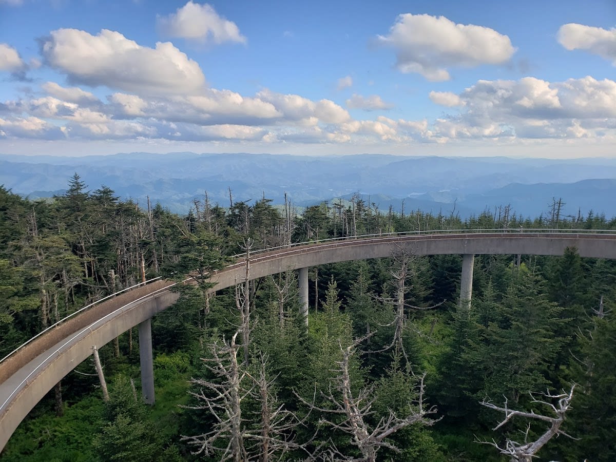
Kuwohi, formerly known as Clingmans Dome, is the highest point in Tennessee and the Great Smoky Mountains National Park, standing at 6,643 feet. Visitors can reach the summit via a steep half-mile paved trail from the parking area. At the top, a distinctive spiral observation tower provides 360-degree panoramic views that extend over 100 miles on clear days. The area is known for cooler temperatures, often 10 to 20 degrees lower than the surrounding valleys, making it a refreshing destination during warmer months.
Kuwohi is named in honor of the Cherokee heritage that permeates the region. The geology of the peak reflects ancient mountain-building forces and is part of the Appalachian range that formed over 200 million years ago. The frequent mists and clouds that give the Smokies their name often envelop Kuwohi, creating a mystical atmosphere. The observation tower was built in the 1950s to provide visitors with a safe way to experience the summit views while protecting the fragile alpine environment.
Visitors to Kuwohi can expect a rewarding experience despite the sometimes unpredictable weather. The paved trail is accessible for most hikers, but the steep incline requires a moderate level of fitness. On clear days, the views stretch across Tennessee, North Carolina, and even as far as the Cumberland Plateau. The cooler air and unique plant life at this elevation make the visit distinct from lower elevations in the park. Remember to bring layers and prepare for changing weather conditions during your visit.


The half-mile paved trail is short but steep, so it requires moderate fitness. It is accessible to most hikers comfortable with uphill walking.
Pets are allowed but must be kept on a leash at all times to protect wildlife and other visitors.
Yes, there is a designated parking area near the trailhead, but it can fill up quickly during peak seasons.
Restroom facilities are available at the parking area near the trailhead but not at the summit.
Yes, on clear days you can see into North Carolina and parts of the Cumberland Plateau from the observation tower.
Branded Locale sticker set arriving soon. Use the heritage benchmark and the editorial portrait on your water bottle, laptop, or Instagram story.