The high Smokies get more than 85 inches of rain a year, and all that water has to come down somewhere. These ten hikes cover the range, from a 1.4-mile stroll to a roaring cascade to an 8-mile climb to the park's tallest waterfall. Laurel Falls is missing on purpose: it is closed for rehabilitation until sometime in 2027.
The park's first waterfall rule is simple: stay off the rocks around the falls, which are slick with mist and algae and have caused deadly falls. The famous trailheads fill early, so start in the morning or ride a shuttle, and bring a parking tag for each car.
In This Guide

Grotto Falls
Grotto Falls is a 25-foot waterfall in a cool mountain cove and the only one in the park where the trail passes behind the falling water. The 2.6-mile round trip on Trillium Gap Trail crosses several streams and winds through old-growth forest and rhododendron. On some days you may share the trail with the llamas that haul supplies to LeConte Lodge.
Good to know: Trailhead is on Roaring Fork, open mid-April through November; parking is tight.
Closest Vantage cabins: Gatlinburg Heights (20-25 min), Great Smoky View (20-25 min)
View Full Guide →
Rainbow Falls
Named for the rainbow that often forms in its mist on sunny afternoons, Rainbow Falls drops nearly 80 feet, the longest single plunge in the park. The 5.6-mile round trip climbs about 1,500 feet on a steep, rocky trail with narrow footbridges over LeConte Creek. Save it for the stronger hikers in your group.
Good to know: The Cherokee Orchard Road trailhead fills fast; the park suggests a shuttle.
Closest Vantage cabins: Gatlinburg Heights (25-30 min), Great Smoky View (25-30 min)
View Full Guide →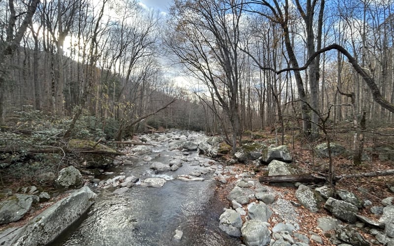
Ramsey Cascades
At 105 feet, Ramsey Cascades is the tallest waterfall in the park. The 8-mile round trip in Greenbrier climbs more than 2,000 feet over roots and rocks, on a trail rebuilt from 2022 to 2024 with new footlog bridges and more than 600 steps. The park specifically asks hikers not to climb to the top of the falls.
Good to know: Strenuous; parking on Ramsey Prong Road is limited, so arrive early.
Closest Vantage cabins: LeConte Mountain Lodge (25-30 min), Creekside Splash (25-30 min)
View Full Guide →
Abrams Falls
Abrams Creek carries a lot of water, and it pours 25 feet over a sandstone ledge into a deep pool at the end of this 5-mile round trip from Cades Cove. Hemlock and rhododendron line the banks, and reintroduced river otters are occasionally seen near the falls. The pool looks inviting, but the park strongly discourages swimming because of an undertow.
Good to know: Bridge work closed it Monday to Thursday through Sept. 30, 2026; check first.
Closest Vantage cabins: Amazing View Lodge (55-65 min), Bears Britches (55-65 min)
View Full Guide →
Mingo Falls
Mingo Falls drops more than 120 feet on the Qualla Boundary, home of the Eastern Band of Cherokee Indians, just outside the national park. The walk is less than half a mile but starts with 161 steps, with a handrail and a bench at the top. A bridge in front of the falls gives everyone a clear view.
Good to know: Park at Mingo Falls Campground, about five miles up Big Cove Road.
Closest Vantage cabins: Four Bears Den (80-90 min), Greystone (80-90 min)
View Full Guide →
Hen Wallow Falls
A 4.3-mile round trip on Gabes Mountain Trail climbs through hardwood forest with hemlock and rhododendron to Hen Wallow Falls, a 90-foot ribbon of water only two feet wide at the top that splits and fans out to about 30 feet at the base. Look for salamanders in the pool below, and expect steep sections and roots.
Good to know: Park in the hiker lot at Cosby Picnic Area and walk back to the trailhead.
Closest Vantage cabins: Creekside Splash (25-30 min), Splash Mountain Lodge (25-30 min)
View Full Guide →Deep Creek Waterfalls Loop
Three waterfalls in one 2.4-mile loop: Juney Whank Falls, an 80-foot cascade you view from a footbridge; Tom Branch Falls; and Indian Creek Falls, a 25-foot slide into a large pool. The loop has some steep sections and stairs, but it suits mixed-age groups on a Cherokee or Bryson City day trip.
Good to know: Park at the end of Deep Creek Road, past the campground.
Closest Vantage cabins: Four Bears Den (95-105 min), Greystone (95-105 min)
View Full Guide →
Baskins Creek Falls
Off the Roaring Fork Motor Nature Trail, Baskins Creek Trail sees far fewer hikers than nearby Grotto or Rainbow Falls. At 1.4 miles, an unmaintained side trail drops to a two-tiered, 40-foot waterfall; that spur is steep and slippery, so take it slowly with kids. Expect wet feet at the Falls Branch crossing after heavy rain.
Good to know: Trailhead is across from Trillium Gap on Roaring Fork; no dogs or bikes.
Closest Vantage cabins: Gatlinburg Heights (15-20 min), Great Smoky View (15-20 min)
View Full Guide →
Middle Prong Trail
The easiest walk on this list is 1.4 miles round trip on an old railroad bed to Lynn Camp Prong Cascades, where the stream rushes and tumbles over big rocks beside the trail. The path is mostly wide and flat, with wildflowers from spring through summer. Keep going upstream if the group wants more miles.
Good to know: Park at the end of gravel Upper Tremont Road; parking tag required.
Closest Vantage cabins: Amazing View Lodge (40-50 min), Bears Britches (40-50 min)
View Full Guide →
Spruce Flats Falls
Spruce Flats Falls is a 30-foot, four-tiered waterfall in a rocky nook above Tremont, reached by a 1.8-mile round trip from the Great Smoky Mountains Institute. The trail has steep, rocky sections and a slippery descent near the end, so sturdy shoes matter. Tremont maintains the trail with private funds and repaired it in 2025.
Good to know: Repairs close it on weekdays through fall 2026; call Tremont before you go.
Closest Vantage cabins: Amazing View Lodge (30-40 min), Bears Britches (30-40 min)
View Full Guide →Drive times to the closest Vantage cabins are measured by road without traffic; allow extra time on the Parkway in peak season.
Tips for Groups
- Go early or pick a quieter trail. The park says Abrams, Grotto, Laurel and Rainbow falls together see more than 200,000 visitors a year, often with limited parking and crowded paths.
- Keep everyone off the rocks at the top and base of every waterfall. The park says several people have fallen to their deaths climbing on rocks near falls.
- For anyone who can't hike, drive Little River Road, Tremont Road or Newfound Gap Road after heavy rain, when roadside waterfalls spill off the mountainsides.
Staying with a big group? Browse Vantage cabins by bedrooms, pools, theater rooms and more, or see our large group cabins.